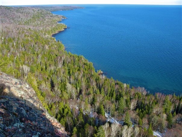
The hiking trails around Lake Superior are almost endless. Lake Superior trails offer a variety of terrain, levels of difficulty, scenic vistas of lookouts with ceaseless views or cascading waterfalls. Whether you’re looking for day hike or a leisurely stroll along the lakeshore, there is bound to be the ideal trail to explore during your Lake Superior Circle Tour.
We have compiled a list of over 200 trails all around the lake. Be sure to add the ones that interest you to your trip so you don’t miss out!

MICHIGAN TRAILS

Round Island Point Nature Preserve Trail
Difficulty: Easy
Round Island Point Nature Preserve Trail is located in Brimley. This trail is a 1.6 mile (2.6 km) loop within this protected habitat in the Upper Peninsula. The preserve offers ample nature viewing opportunities for hikers. It is within a major flyway for migrating waterfowl as well as many other birds. Hiking here is good for all skill levels with some nice views of the bay.

Mission Hill Trail
Difficulty: Moderate
Mission Hill Trail is located near Brimley in Michigan’s Chippewa County within the Hiawatha National Forest. This is a 3.6 mile (5.8 km) scenic out and back trail that takes hikers along the spectacular Spectacle Lake and Monocle Lake.

Upper and Lower Falls Trail
Difficulty: Moderate
Upper and Lower Tahquamenon Falls is located within Tahquamenon Falls State Park. This is a 10.8 mile (17.3 km) out and back trail that leads from the upper falls and along the Tahquamenon River to the lower falls. The trail is paved with boardwalk viewing platforms. The park has a track chair program that helps visitors explore areas with off-road electronic chairs, where traditional wheelchairs might not be able to easily access.
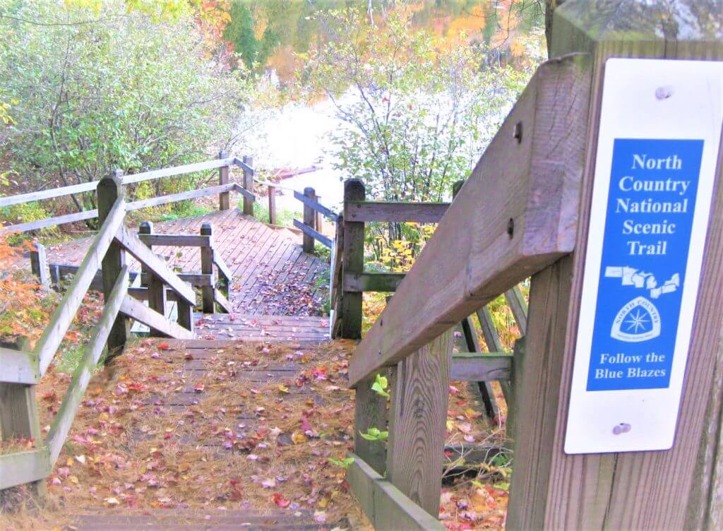
North Country Trail
Difficulty: Moderate
North Country Trail: Lower Falls to Old Stove is also located within Tahquamenon Falls State Park. The trail is a 5.2 mile (8.4 km) point to point section of the North Country trail that begins at the Lower Tahquamenon Falls and leads to the Old Stove backcountry site. Dogs are able to use this trail but must be kept on a leash.

Paradise Pathway Loop
Difficulty: Easy
Paradise Pathway Loop is located 1 mile west of Paradise in Michigan’s Chippewa County on M-123. It is a 1.7 mile (2.7 km) loop trail. This trail is great for all skill levels and is often utilized for wildlife viewing, hiking and cross-country skiing. Dogs are able to use this trail but must be kept on a leash.

Clark Lake Loop
Difficulty: Moderate
Clark Lake Loop is located in Tahquamenon Falls State Park. The Clark Lake Loop is a 5.2 mile (8.3 km) trail that begins at the parking lot on Clark Lake Road. The trail traverses through pine forests and offers views of the picturesque Clark Lake. The route contains several areas of silver and green lichens, ferns, blueberries, jack pine uplands and moss-carpeted lowlands.

Two Hearted River Trail
Difficulty: Moderate
Two Hearted River Trail is located near Newberry Michigan. This is a 2.3 mile (3.7 km) out and back trail that begins at Two Hearted River State Forest Campground. The trail is primarily used for hiking, walking and running and has some sandy spots and a few steep but short hills along Lake Superior.

Sable Falls Trail
Difficulty: Moderate (due to stairs)
Sable Falls Trail is located near Grand Marais Michigan. This is a 1.2 mile (2 km) out and back trail on the eastern portion of the Pictured Rocks National Lakeshore. The trail has a set of stairs that take you down 200 steps to the base of the falls. The hiking trails continue down the canyon past the falls and follows the creek to Sable Falls beach on Lake Superior. Pets are allowed on leash.

Grand Sable Dunes Loop
Difficulty: Easy
Grand Sable Dunes Loop is located near Grand Marais. It is a 0.7 mile (1.2 km) round trip trail in the Pictured Rocks National Lakeshore. This is the main access point into the Grand Sable Dunes. The trail starts at the west end of the Sable Falls parking area and continues past an old apple orchard and crosses a bridge over Sable Creek. The trail then winds through trees and into the open Sable Dunes. There is some uphill climbing in sand. Pets are allowed on leash.

Hurricane River to Log Slide
Difficulty: Moderate
Hurricane River to Log Slide is also located near Grand Marais. It is a 7.5 mile (12.2 km) out and back trail in the Pictured Rocks National Lakeshore. This trail leads you along through mature hardwoods to the western edge of the Grand Sable Dunes where logs once slid down to the lake. This overlooks Lake Superior, the Grand Sable Dunes and Au Sable Lighthouse. Pets allowed on leash.

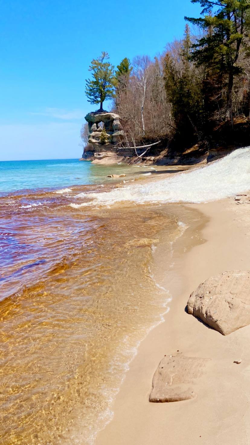
Au Sable Light Station Trail
Difficulty: Easy
Au Sable Light Station Trail is located near Grand Marais. It is a 3 mile (4.8 km) out and back trail in the Pictured Rocks National Lakeshore. The trail begins at Hurricane River Campground and take you along the old access road and Lake Superior to the isolated Au Sable Light Station. Along the way you will see exposed shipwreck remains that dot the shoreline. Leashed pets are allowed on the trail and light station grounds.

Beaver Lake Loop
Difficulty: Moderate
Beaver Lake Loop is 1 mile (1.6 km) east of Grand Marais. It is a 5.5 mile (8.8 km) loop trail on the Pictured Rocks National Lakeshore. This trail is very scenic and varied. Hike through wooded areas, around Beaver Lake, along Beaver Creek and Lake Superior. No pets allowed on this trail.
Chapel Loop
Difficulty: Moderate
Chapel Loop is located in Munising. It is a 10 mile (16 km) loop trail on the Pictured Rocks National Lakeshore. Hikers will be have access to views of cliffs, coves, arches, and rockfalls from atop the sandstone bluffs these features are made of. The hike begins by crossing the Mosquito River basin, the majority of the route follows the North Country Trail along the cliffs of Pictured Rocks overlooking Lake Superior and Chapel Rock. No pets allowed on this trail.

Miners Castle Trail
Difficulty: Easy
Miners Castle Trail is also located in Munising. It is a 0.4 mile (0.8 km) out and back on the Pictured Rocks National Lakeshore. This is a short trail that leads you from the Miners Beach parking lot to a platform that overlooks Miners Castle Rock, one of the most popular landmarks along the Pictured Rocks shoreline. No pets allowed on this trail.

Miners Falls Trail
Difficulty: Easy
Miners Falls is located in Munising within Pictured Rocks National Lakeshore. This is probably the most accessible of waterfalls of Pictured Rocks. A short and easy 0.6 mile (0.9 km) walk takes you from the parking lot to the falls. There are 2 viewing platforms for you to enjoy this 50 feet (15.2 m) waterfall cascading over a sandstone cliff. Leashed dogs allowed.

Sand Point Marsh Trail
Difficulty: Easy
Sand Point Marsh Trail is located 4 miles (6.4 km) northwest of Munising. It is a 1.2 mile (1.9 km) loop on the Pictured Rocks National Lakeshore. Across from Sand Point Beach, this wheelchair accessible boardwalk trail takes you through beautiful wetlands. Old beach ridges, a cattail marsh, small ponds, white cedar and black spruce is the scenic experience of this trail. No pets allowed on this trail.

Munising Falls Trail
Difficulty: Easy
Munising Falls Trail is located in Munising. It is an easy 0.4 mile (0.6 km) out and back trail on the Pictured Rocks National Lakeshore. This trail is paved and leads you along Munising Creek to the central viewing platform to view the 50 foot (15.2 m) waterfall. There are two platforms up sets of stairs that offer different perspectives of the falls. Leashed dogs are allowed

Olson Falls Trail
Difficulty: Easy
Olson Falls trail (also known as Tannery Falls) is located near Munising. It is an easy 0.4 mile (0.6 km) out and back trail along Tannery Creek to the 40 foot tall Olson Falls. The grave site of Rudolf M. Olsen (1909-1982) can be seen on the path along a set of stairs that leads up a hill. A sand stone cave is tucked behind the falls where visitors can walk behind. This waterfalls is best seen in spring or after a heavy rain. No dogs allowed on this trail. Memorial Falls is also nearby and can be accessed on the same trail.

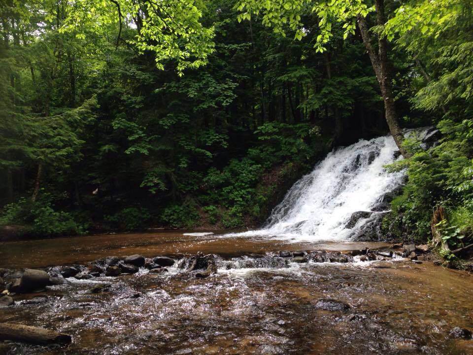
Wagner Falls Lookout Trail
Difficulty: Easy
Wagner Falls Lookout Trail is located near Munising. It is an easy 0.18 mile (0.3 km) out and back trail beginning at the Wagner Falls Parking area on Hwy 94. The trail and falls are nestled amid beautiful pine and hemlock trees. An observation deck overlooks the Wagner Falls.

Grand Island Loop
Difficulty: Hard
Grand Island Loop is located on Grand Island north of Munising. It is a 21.2 mile (34.1 km) loop trail that leads you around the shores of Grand Island. It is considered difficult based on the distance though the terrain is easily hiked or biked with several beaches along the way. If you decide to do the entire loop, make sure you give yourself enough time if you are taking the ferry back that day and not camping for the night. Leashed dogs are allowed.

Au Train Lake to Lake Superior Paddle Trail
Difficulty: Moderate
The Au Train Lake to Lake Superior Trail is located in Au Train in the heart of the Hiawatha Forest. This is a paddling trail that is 10.5 miles (16.9 km) beginning at the Au Train Lake Boat Launch located at the end of Campground Road. Paddle through Au Train Lake, navigate Au Train River until you reach Lake Superior. Canoe and kayak rentals are available in the area.

Valley Spur Trail
Difficulty: Varied
Valley Spur Trail is located 5 miles from Munising in the heart of the Hiawatha National Forest. This is a 27 mile (45 km) trail system that is utilized by cross-country skiers, hikers and mountain bikers. Ten scenic trail loops make up this well groomed and maintained trail system.

Laughing Whitefish Falls Trail
Difficulty: Easy
Laughing Whitefish Falls Trail is located in Sundell, 30 miles (48.2 km) from Munising. This is a 1 mile (1.6 km) out and back trail that leads to the top of Laughing Whitefish Falls Scenic Site. A long staircase leads to the bottom of the falls and observation deck. The waterfall is an impressive 100 foot (30.5 m) high slide and is one of the tallest and accessible waterfalls in Michigan. Leashed dogs are allowed.

Eben Ice Caves Trail
Difficulty: Moderate
Eben Ice Caves Trail is located near Eben Junction in Deerton Michigan. This is a 2.1 miles (3.5 km) out and back trail that leads to the Eben Ice Caves, also known as the Rock River Canyon Ice Caves. While this is a popular winter attraction once the ice caves freeze up, the trail can also be utilized in the summer though you would see little to no running water. If coming to see the ice caves, it is recommended that you plan appropriately for snow and ice. Snowshoes or ice cleats and dressing appropriate for the weather. Leashed dogs are allowed.

Tyoga Historic Pathway
Difficulty: Easy
Tyoga Historic Pathway is located 3 miles (4.8 km) north of Deerton. This is a 1.6 mile (2.6 km) loop trail within the Escanaba River State Forest. The trail loops around the remains of an old logging town where workers from the Tyoga Lumber Company lived between 1905 – 1907. This trail is often wet and sometimes floods. Consider waterproof footwear when exploring this trail. Leashed dogs are allowed.
Morgan Falls via Marquette Mountain Road
Difficulty: Moderate
Morgan Falls via Marquette Mountain Road is located about 2 miles (3.2 km) south of Marquette. This is a 2.7 miles (4.5 km) out and back trail down Marquette Mountain Road that leads to Morgan Falls that is formed with Morgan Creek and joins with Carp River.

Gorge-ous, Doctors and Grom Loop Trail
Difficulty: Moderate
Gorge-ous, Doctors and Grom Loop Trail is located in Marquette. The trail is 3.9 mile (6.3 km) loop trail that starts at the Noquemanon South Trails Trailhead. It takes you along Carp River and offers incredible views at the Mount Marquette Overlook. Leashed dogs allowed.

Mount Marquette Loop
Difficulty: Moderate
Mount Marquette Loop is located in Marquette. The trail is 4.4 mile (7.1 km) loop trail that starts at the Mount Marquette Road and is also known as the Blue Loop. The trail is accessible in all season and curves around rocky bluffs, through beautiful forest and the Mount Marquette Overlook.

Noquemanon Trails Network
Difficulty: Varied
Noquemanon Trails Network is located from Marquette to Big Bay in Michigan’s Marquette County. This is a series of 7 trail systems that include over 65 miles (104.6 km) of single track trail, 35 miles (56.3 km) of groomed winter single track, over 77 miles (125 km) of Nordic ski trails and 2 pump tracks. Visit the Noquemanon Trail Network website for more details about each trail.

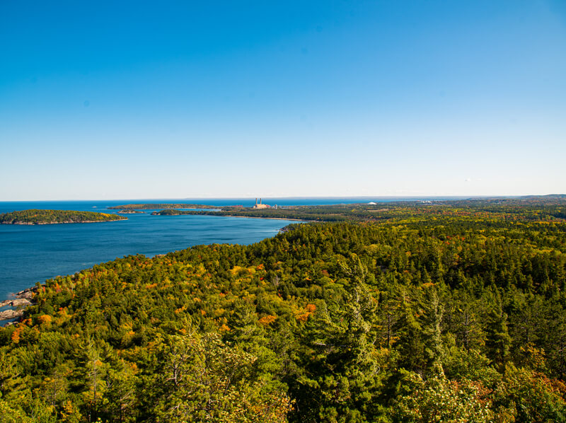
Presque Isle Park Loop
Difficulty: Easy
Presque Isle Park Loop is located in Marquette. This is a 2.7 mile (3.5 km) paved loop that takes you around Presque Isle Park with incredible views of cliffs over looking Lake Superior, Black Rocks, and the Presque Isle Harbour Breakwater Lighthouse. The road is seasonal and in the winter it is only open to non-motorized travel. During the summer, it is closed to vehicles during certain hours and is perfect for safe hiking.

Presque Isle River Waterfalls Loop Trail
Difficulty: Moderate
Presque Isle River Waterfalls Loop Trail is located near Wakefield Michigan. This is a 2.3 mile (3.7 km) loop trail on the western edge of Porcupine Mountains Wilderness State Park. The hike includes sections of boardwalk and stairs, wooded trail, a suspension bridge and three main waterfalls of the Presque Isle River. The waterfalls include, Manabezho Falls, Manido Falls and Nawadaha Falls.
Sugarloaf Mountain Loop
Difficulty: Easy
Sugarloaf Mountain Loop is located 6 miles (9.6 km) north of downtown Marquette. This is a 1.1 mile (1.9 km) loop trail that offers an incredible view up the mountain and a forest canopy that envelops the trail. A dirt trail turns to a series a wooden stairs that leads to the top of Sugarloaf Mountain with stunning views of Lake Superior. Leashed dogs allowed.

Dead River Falls Trail
Difficulty: Moderate
Dead River Falls Trail is located 2 miles west of Marquette. This is a 0.6 mile (1.1 km) out and back trail that features a series of falls and rapids. The river drops 90 feet (27 m) in a half mile stretch offering three drops that are over 15 feet (4.5 m) and several small drops and rapids along the way. Navigating this trail with some portions having high rocky walls or paths on high sandy banks may be tricky though relatively easy for able-bodied hikers. Leashed dogs allowed.

Hogback Mountain Trail
Difficulty: Moderate
Hogback Mountain Trail is located near Marquette. This is a 2.8 mile (4.5 km) out and back trail with multiple staircases, through narrow and twisty woodlands, rock fields, swampy areas and vertical rock face. Though some portions may be strenuous, the panoramic view from the top of Hogback Mountain is well worth the trek. Leashed dogs allowed.

The Ultimate North Marquette Loop
Difficulty: Moderate
The Ultimate North Marquette Loop is located in Marquette. This is a 7.8 mile (12.6 km) loop trail that is popular among cyclists. The trail can begin at the Marquette Light and Power trailhead or Tourist Park. Leashed dogs allowed.

Harlow Lake Trail
Difficulty: Easy
Harlow Lake Trail is located in Marquette’s Little Presque Isle Recreation Area. This is a 2.4 mile (3.9 km) out and back trail that is great for all skill levels and utilized year round. The trail offers picturesque views of the surrounding terrain, Lake Harlow and Lake Superior. Leashed dogs allowed.

Marquette City Multi-use Path
Difficulty: Easy
Marquette City Multi-use Path is located in Marquette. This is a 12 mile (19.3 km) paved trail that leads you from the Ore Dock up to Presque Isle. The trail takes you through some of the most scenic and historic parts of the city on the shores of Lake Superior. Leashed dogs allowed.

Little Garlic River Trail
Difficulty: Moderate
Little Garlic River Trail located near Negaunee, 12 miles (19.3 km) north of Marquette. This is a 7.8 mile (12.6 km) well marked, out and back trail within the Escanaba River State Forest that follows along Little Garlic River to the bottom of Little Garlic Falls. The waterfall is a small, rocky slide near a large rock wall that flows into a deep pool. Leashed dogs allowed.

Al Quaal Trail
Difficulty: Hard
Al Quaal Trail is located near Ishpeming Michigan. This is a 4.9 miles (8.0 km) loop trail around the Al Quall Recreational Area. This area is utilized year round and is popular among cross country skiers and mountain bikers. Leashed dogs allowed.

Van Riper Park River Trail
Difficulty: Easy
Van Riper Park River Trail is located near Michigamme. This is a 2.1 mile (3.4 km) loop trail within Van Riper State Park. Hikers and cross country skiers will find themselves going through deep pine forests and catching views overlooking Peshekee River. Leashed dogs allowed.

Craig Lake Trail
Difficulty: Moderate
Craig Lake Trail is located near Michigamme. This is a 5.2 mile (8.5 km) out and back trail along the lake within Craig Lake State Park, the most remote state park in Michigan. Leashed dogs allowed.

Canyon Falls & Gorge Trail
Difficulty: Easy
Canyon Falls & Gorge Trail is located 7 miles (11.2 km) south of L’Anse Michigan. This is a 3.9 miles (6.3 km) out and back trail within Canyon Falls Roadside Park. The trail leads along Sturgeon River to a series of rapids, Canyon Falls and the gorge. At the trail head there is a rest stop with picnic tables and pit toilets. Leashed dogs allowed.

White Deer Lake Trail
Difficulty: Easy
White Deer Lake Trail is located near Michigamme. The trail is a 6.8 mile (11.1 km) out and back trail within the McCormick Wilderness in Ottawa National Forest. The trail goes by Camp Eleven Lake with a mixture of northern hardwoods and lowland conifers with patches of towering white pine and ends at White Deer Lake. This trail is dog friendly.

Yellow Dog Falls Trail
Difficulty: Moderate
Yellow Dog Falls Trail is located 10 miles (16 km) south of Big Bay. The trail is a 4.4 mile (7.2 km) out and back trail in the northeast part of McCormick Wilderness in Ottawa National Forest and leads to Yellow Dog Falls. Leashed dogs allowed.

Mount Arvon Trail
Difficulty: Hard
Mount Arvon Trail is located 27 miles (43.4 km) from L’Anse Michigan. This is a 11.1 mile (18 km) out and back trail up Michigan’s highest point at 1,979.238 feet above sea level. The hiking trail to the summit of Mount Arvon was created by avid hikers in 2017 but now, you can drive within 2 miles from the top and hike the rest of the way.

Hungarian Falls Trail
Difficulty: Moderate
Hungarian Falls Trail is located in Hubbell Michigan. This is a 1.5 miles (2.4 km) out and back trail that follows a gorge upstream to the falls. There are trails on both sides of the gorge with a bridge that crosses Dover Creek between the middle and upper falls. Leashed dogs allowed. There are three drops with the largest being 50 feet (15.2 m) . The total height of the falls is 90 feet (27.4 m). The base of the water fall is made up of Jacobsville Sandstone.
Bare Bluff Trail
Difficulty: Moderate
Bare Bluff Trail is located near Bete Grise in Michigan’s Keweenaw County within the Russell and Miriam Grinnell Memorial Nature Sanctuary. This is a 3 mile (4.8 km) rugged loop trail that goes up and along Bare Bluff. The bluff is a large monolith that stands 588 feet above Lake Superior and offers incredible panoramic views. There are portions of this trail that have steep cliffs and slippery areas. Please use caution and watch your footing.

Nicole Bloom Memorial Trail
Difficulty: Moderate
Nicole Bloom Memorial Trail is located in Mohawk Michigan. This is a 6.2 mile (10.1 km) out and back trail with a 800 foot elevation gain. This forested trail will take you past pristine streams and to an elevated peak known as Mount Baldy, with panoramic views of Eagle Harbor, Lake Bailey and Lake Superior. Leashed dogs allowed.

Estivant Pines Loop
Difficulty: Moderate
Estivant Pines Loop is located near Mohawk. This is a 1.5 mile (2.4 km) loop trail within Estivant Pines Wilderness Nature Sanctuary. The sanctuary contains hundreds of 300-500 year old eastern white pines measuring from 3 to 5 feet in diameter. The trail has some exposed roots and rocky so watch you footing. Leashed dogs allowed.

Horseshoe Harbor Trail
Difficulty: Moderate
Horseshoe Harbor Trail is located near Copper Harbor. This is a (4.8 km) out and back trail that leads through fairly dense forest to Horseshoe Harbor Beach through Mary Macdonald Preserve. This trail begins down a bumpy road. If you are looking for a shorter walk, you can instead begin your hike at High Rock Bay Road. Leashed dogs allowed.

Montreal Falls Trail
Difficulty: Moderate
Montreal Falls Trail is located near Mohawk. This is a 5.2 mile (8.5 km) out and back trail that features a pair of waterfalls on the Montreal River on the shore of Lake Superior.
Maasto Hiihto / Churning Rapids Loop
Difficulty: Easy
The Maasto Hiihto / Churning Rapids Loop is located near Hancock. This is a 7.5 mile (12.2 km) multiuse loop trail. The Maasto Hiihto trail follows the Swedetown Creek down its incredibly beautiful Gorge. Maasto Hiihto translates to “cross country ski” in Finnish. The most northern loop of this trail connects with the Churning Rapids Trail which features a 15 foot high observation tower that overlooks Lake Superior and a picturesque meadow trail leads hikers to the beaver pond. This trail is dog friendly.

Nara River Boardwalk
Difficulty: Easy
Nara Nature Trail Boardwalk is located in Houghton. This is a 0.6 mile (1.1 km), 6 foot wide, out and back boardwalk trail. It runs along both banks of the Pilgrim River and has fishing sites, benches and access for launching kayaks and canoes. Nara Nature Park is a 100 acre nature park located 2 miles (3.2 km) east of the Michigan Tech University Campus. Leashed dogs allowed.

Black Creek Nature Sanctuary Hiking Trail
Difficulty: Moderate
Black Creek Nature Sanctuary Hiking Trail is located near Calumet. This is a 3.4 mile (5.5 km) out and back trail that provides varied landscapes and 1500 feet of Lake Superior shoreline. It runs along three creeks, past active beaver dams, a lagoon and through wildlife.

Keweenaw Point Trail
Difficulty: Moderate
Keweenaw Point Trail is located near Copper Harbor Michigan, at the northernmost point of the Keweenaw Peninsula. This is a 17.7 mile (28.6 km) out and back trail that begins at Fort Wilkins Historic State Park and follows along a multi-use path to Schlatter Lake, High Rocks Bay and Keweenaw Point.

Bear Lake Trail
Difficulty: Easy
Bear Lake Trail is located in McLain State Park near Hancock. This is a 2.1 mile (3.5 km) loop trail that has lovely views of Bear Lake enveloped among the woods and rolling hills and Lake Superior. The trail is generally level and smooth which makes it an easy hike even for inexperience hikers to walk, jog or run. Leashed dogs allowed.

Peepsock Trail
Difficulty: Easy
Peepsock Trail is located near Houghton. This is a (2.7 km) out and back trail that follows Peepsock Creek to the Portage Shoreline. The trail is great for all skill levels and is used for hiking, walking, nature viewing and bird watching. Leashed dogs allowed.

Cascade Falls Trail
Difficulty: Moderate
Cascade Falls Trail Michigan is located near Bergland Michigan. This is a 1.9 mile (3.2 km) loop trail in the Ottawa National Forest. There are two trails that will lead you to Cascade Falls, the main trail is the easiest hike with only small changes in elevation. The Bluff Trail joins the main trail and is more challenging but offers incredible vistas. Leashed dogs allowed.

Trap Hills Traverse
Difficulty: Moderate
Trap Hills Traverse is also located near Bergland. This is a 6.2 mile (10km) loop trail in the Ottawa National Forest. Leashed dogs allowed. The Trap Hills offers scenic vistas, abundant wildlife, rare plants, a fascinating history and a wide array of recreation opportunities.

Black River Waterfalls Trails
Difficulty: Moderate
The Black River Waterfalls Trails are located north of Bessemer in Michigan’s Gogebic County. Along the Black River National Scenic By-Way, within the Ottawa National Forest, you will find a series of five awe inspiring waterfalls.
Great Conglomerate is the first of the five beginning upstream of the river. The trail is about ¾ mile from the marked Potawatomi/Gorge Falls parking lot. The trail includes stairs and an observation platforms. This waterfall drops 30 feet (9.1 m) and when the water is lower, it splits in two around large conglomerate rock. Hence where the name was derived.
Potawatomi Falls can be reached from the same parking lot as the Great Conglomerate. The trail is about 1/8 mile long with an observation platform. The falls has a 30 foot (9.1 m) drop of white water and is 130 feet (39.6 m) wide. This waterfall is wheelchair accessible.
Next is Gorge Falls and just downstream from Potawatomi Falls. The trail is about 1/8 miles with plenty of stairs to an observation platform. This waterfall is 25 feet (7.6 m) high with a narrow crest of 10 feet (3 m). The deep and narrow gorge above and bellow the falls is where it gets it’s name.
Sandstone Fall is the smallest of the waterfalls and the trail is approximately ¼ mile. The hike is short but steep with a series of stairs. The falls is 15 feet (4.5 m) high and 30 feet (9 m) wide cascading over sandstone and conglomerate rock.
Rainbow Falls is the last of five waterfalls in the Black River before meeting Lake Superior. You can access the waterfall two ways – park at the Black River Harbor parking lot and cross the suspension bridge over the river and hike upstream for about ½ a mile, or at the Rainbow Falls parking area where you hike about ¾ miles to a set of stairs leading down to a viewing platform. Rainbow Falls is 40 feet (12 m) high and with the perfect amount of sunlight and at the angle, the mist produces a rainbow effect.

Gogebic Ridge Trail
Difficulty: Moderate
Gogebic Ridge Trail is located near Bergland. This is a 8 mile (12.8 km) trail that begins along Weary Lake, then overlooks Lake Gogebic and bends through rolling hills and trees.

Wolf Mountain Trail
Difficulty: Moderate
Wolf Mountain Trail is located near Wakefield Michigan. This is a 0.6 mile (1.1 km) out and back trail that leads you to the highest peak in the county, Wolf Mountain. The trail is short but quite steep through maple and oak trees and diverse plant life. The top offers incredible panoramic views.
Presque Isle River Waterfalls Loop Trail
Difficulty: Moderate
Presque Isle River Waterfalls Loop Trail is a 2.3 mile (3.7 km) loop trail on the western edge of Porcupine Mountains Wilderness State Park. The hike includes sections of boardwalk and stairs, wooded trail, a suspension bridge and three main waterfalls of the Presque Isle River. The waterfalls include, Manabezho Falls, Manido Falls and Nawadaha Falls.
Manabezho Falls is the largest drop on the river at approximately 25 feet (7.6 m) high and 150 feet (45.7 m) wide. This is the first falls you will encounter on the trail. There is an overlook at the top of the falls and it can be seen from either side of the river on this loop trail. The falls is named after the Ojibway god Manabezho.
Manido Falls is the second and smallest waterfall you will encounter on this trail. It has a drop of about 15 feet (4.5 m) and has a crest between 50 and 150 feet (15m – 45.7m) depending on the amount of water flowing – spring is the best time. A set of stairs will lead you to an overlook above the falls. Manido is an Ojibway word meaning “spirit” or “ghost”.
Nawadaha Falls is the final waterfall on this trail. This may be considered the most scenic of the three. It has a drop of about 15 feet (4.5 m) and has a crest up to 150 feet (45.7m). There is a natural viewing platform above the falls as well as a short trail that leads to it on the east side of the river. Nawadaha is Ojibway for “in the midst of rapids”.

Summit Peak Trail
Difficulty: Moderate
Summit Peak Trail is a 0.8 mile (1.4 km) out and back trail within Porcupine Mountains Wilderness State Park. The short but steep trail leads to the Summit Peak Observation Tower with breathtaking views from 1,958 feet. This is the highest point in the Porcupine Mountains. There are benches along the way and the hike is finished with an overlook and the viewing platform. Leashed dogs allowed.

Escarpment Trail
Difficulty: Hard
Escarpment Trail is a 8.2 mile (13.2 km) out and back trail within Porcupine Mountains Wilderness State Park. The trail combines a high rocky bluff and alpine vistas with views of the parks rugged interior, Upper Carp Valley and Lake of the Clouds. Leashed dogs allowed.

Big Carp River Trail
Difficulty: Moderate
Big Carp River Trail is a 9.6 mile (15.4 km) out and back trail within Porcupine Mountains Wilderness State Park. The trail begins at the Lake of the Clouds Scenic Overlook and ends at the mouth of the Big Carp River. There are eight backcountry campsites along the Big Carp Trail. Leashed dogs allowed.

Union Mine Trail
Difficulty: Moderate
Union Mine Trail is a 1.1 mile (1.8 km) loop trail within Porcupine Mountains Wilderness State Park. The trail features 10 interpretive plaques that tell the story of the copper mining history of the Porcupine Mountains. Cascading falls can be seen along the trail particularly during rainy seasons. Leashed dogs allowed.

Lake Superior Trail
Difficulty: Hard
Lake Superior Trail is a 16.5 mile (26.7 km) out and back trail within Porcupine Mountains Wilderness State Park. The rugged trail offers hikers a more secluded experience that goes along the shore of Lake Superior. Along the way, you will enjoy several picturesque views of the lake, waterfalls, the Presque Isle River and back country camp sites. Leashed dogs allowed.

Lake of the Clouds Trail
Difficulty: Easy
Lake of the Clouds Trail is a 1.4 mile (2.3 km) out and back trail within Porcupine Mountains Wilderness State Park. Lake of the Clouds is the most photographed feature in park. It can be easily reached by a fully accessible overlook. It can also be reached from the Big Carp River Tail and the Escarpment Trail. Leashed dogs allowed.

Pinkerton Creek Trail
Difficulty: Easy
Pinkerton Creek Trail is a 4.9 mile (7.9 km) out and back trail within Porcupine Mountains Wilderness State Park. It is a scenic walk that crosses several bridged streams and creeks. Pinkerton Trail bypasses from the west end of the Lake Superior Trail and leads to cabins and campsites near the mouth of the Big Carp River.

Mirror Lake Trail
Difficulty: Moderate
Mirror Lake Trail is a 5 mile (8.2 km) out and back trail within Porcupine Mountains Wilderness State Park. The trail begins at Summit Peak and ends at the wooded shores of Mirror Lake. Excellent forest camping can be found here. Leashed dogs allowed.

Lost Lake Trail
Difficulty: Moderate
Lost Lake Trail is a 6.5 mile (10.6 km) out and back trail within Porcupine Mountains Wilderness State Park. Lost Lake Trail extends from South Boundary Road to Government Peak Trail and along the way passes a yurt, a backcountry campsite and, of course, its namesake a small, remote, and beautiful lake. Leashed dogs allowed.

Greenstone Ridge Trail
Difficulty: Hard
Greenstone Ridge Trail is located on Isle Royale National Park. This is a 40 mile (64.3 km) point to point trail that extends from Windigo Harbor to Rock Harbor, spanning the entire length of the park. High quality and well maintained trails and infrastructure make camping very comfortable. The trail mainly follows the top of Greenstone Ridge that is a low ridge that forms the spine of the island goes over Mount Desor which is the highest point of Isle Royale.
Visitors to Isle Royale National Park must arrive by boat or seaplane. There are transportation services that depart from Houghton, MI, Copper Harbor, MI, and Grand Portage, MN.

Rock Harbor Trail
Difficulty: Moderate
Rock Harbor Trail is located on Isle Royale National Park. This is a 20.6 mile (33.2 km) out and back trail that begins at the Rock Harbor Visitor Center and follows along the shores of Rock Harbor on Lake Superior. Back Country camping options are available along the way.

Scoville Point Loop
Difficulty: Moderate
Scoville Point Loop is located on Isle Royale National Park. This is a 4.9 mile (7.9 km) loop trail that loops around Rock Harbor to Scoville Point and back. There are breathtaking vistas of the Lake Superior shoreline throughout the hike.

Feldtmann Lake Loop Trail
Difficulty: Hard
Feldtmann Lake Loop Trail is located on Isle Royale National Park. This is a 32.8 mile (52.9 km) loop trail that is a pleasant walk that takes you into the southwest part of the park and provides a glimpse into the extensive swamp along Big Siskiwit River and Feldtmann Lake. Back Country camping options are available along the way.

Tobin Harbor Trail
Difficulty: Easy
Tobin Harbor Trail is located on Isle Royale National Park. This is a 5.9 mile (9.5 km) out and back trail that begins at the Rock Harbor Lodge and follows small rises and dips along the south shore of the scenic Tobin Harbor.

Mount Ojibway Trail
Difficulty: Moderate
Mount Ojibway Trail is located on Isle Royale National Park. This is a 3 mile (5 km) out and back trail that takes from the Daisy Farm Campground and on a gradual climb to the summit at Ojibway Lookout Tower.

Minong Ridge Trail
Difficulty: Hard
Minong Ridge Trail is located on Isle Royale National Park. This is a 52 mile (83.8 km) out and back trail that can either begin at Rock Harbor or Windigo. Portions of this challenging trail offers incredible panoramic views of Lake Superior and Canada to the north of the island. Back country camping is available along the trail.

Stoll Trail
Difficulty: Easy
Stoll Trail is located on Isle Royale National Park. This is a 4.1 mile (6.6 km) loop trail that begins at Rock Harbor Lodge through old growth forest, along craggy shoreline bluffs and through some swampy sections. The trail offers breathtaking views of Lake Superior and the surrounding islands.

Lane Cove Trail
Difficulty: Hard
Lane Cove Trail is located on Isle Royale National Park. This is a 13.4 mile (21.7 km) out and back trail that drops steeply from the Greenstone Ridge Trail and ends at the Lake Cove campsite. The campsite is along the shoreline and offers picturesque views of the cove, near by islands and even Thunder Bay Ontario, which is 12 miles (19.3 km) away.

Huginnin Cove Trail
Difficulty: Moderate
Huginnin Cove Trail is located on Isle Royale National Park. This is a 9 mile (14.5 km) loop trail that starts at Windigo and takes you through dense forest, crossing multiple streams, passing a couple of old copper mining log cabin ruins and the cobble stone beach of Huginnin Cove.

Mount Franklin Trail
Difficulty: Moderate
Mount Franklin Trail is located on Isle Royale National Park. This is a 9.3 mile (15.1 km) out and back trail that connects the Rock Harbor Trail to the Greenstone Ridge Trail. The trail climbs up the spine of Isle Royale’s Greenstone Ridge. Mount Franklin isn’t really a mountain but a 1080 foot high rock bluff along the ridge that offers incredible views of Canada, Lake Superior and the north side of Isle Royale.

Daisy Farm Trail
Difficulty: Easy
Daisy Farm Trail is located on Isle Royale National Park. This is a 3.7 mile (6 km) out and back trail that is a connector trail to the Greenstone Ridge beginning at Daisy Farm Campground.

Indian Portage Trail
Difficulty: Moderate
Indian Portage Trail is located on Isle Royale National Park. This is a 19.6 mile (31.7 km) out and back trail that traverses the wild interior of Isle Royale. The trail provides access to Chickenbone Lake, Greenstone Ridge, Lake Sivermore, LeSage Lake, Lake Richie, and Chippewa Harbor. Back country camping is available along the way.

Windigo Nature Trail
Difficulty: Easy
Windigo Nature Trail is located on Isle Royale National Park. This is a 1.1 mile (1.9 km) loop trail that takes you from the Visitor Center and along the hills around Windigo. This is an easy interpretive trail that exhibits the effects over time of nature and man upon Isle Royale.

Ishpeming Trail
Difficulty: Moderate
Ishpeming Trail is located on Isle Royale National Park. This is a 14.6 mile (23.5 km) out and back trail that begins at Malone Bay and takes you along the shoreline of Siskiwit Lake to Ishpeming Point on the Greenstone Ridge. Ishpeming Point is the second highest point on Isle Royale at 1377 feet.

Raspberry Island Hike
Difficulty: Easy
Raspberry Island Hike is located on Isle Royale National Park. This is a half mile (0.9 km) loop on Raspberry Island. The island can be reached by taking a boat tour departing from Isle Royale’s Rock Harbor. The trail starts at the day use only dock and takes a short loop exploring the woods and views from the island’s rocky shores.
WISCONSIN TRAILS

Houghton Falls Trail
Difficulty: Easy
Houghton Falls Trail is located just north of Washburn, Wisconsin. This is a 1.3 mile (2.1 km) out and back trail within the 76 acre Houghton Falls Natural Area. The trail takes you into the woods to the falls and continues to the Lake Superior shoreline with views of the Apostle Islands. The spring season or after a heavy rain is the best time to visit this low flow falls. Though even if the water isn’t flowing, the scenic dells area and sandstone gorge is definitely worth the stop.
Leashed dogs allowed.

North Country Scenic and Doughboy’s Loop
Difficulty: Easy
North Country Scenic and Doughboy’s Loop is located just near Mellen Wisconsin. This is a 1.6 mile (2.7 km) loop trail within Copper Falls State Park. It loops around the junction of Tyler Fork and the Bad River and Brownstone Falls and Copper Falls are viewable from this trail.

Potato River Falls Trail
Difficulty: Easy
Potato River Falls Trail is located just near Gurney, Wisconsin. This is a 0.8 mile (1.3 km) out and back trail that takes you to Upper and Lower Potato River Falls. The trail consists of stairs, boardwalks and viewing platforms.
Right next to the parking lot there is an observation deck that allows you to view Lower Potato Falls. This water fall is quite impressive with a height of 50 feet (15.4 m) tall and 100 feet (30.4 m) wide. The trail leads you to a set of stairs that leads you down into the gorge and to another observation platform. Taking the trail upstream you will reach Upper Potato Falls. This water fall has several drops going in different directions that make it a height of 40 feet (12 m). Another observation deck allows you a decent vantage point.

Red Granite Falls Trail
Difficulty: Easy
Red Granite Falls Trail is a 2.5 mile (4 km) loop trail within Copper Falls State Park that starts at the parking area for Loon Lake. This is a wide and well maintained figure eight loop that takes you Bad River and various overlooks of Granite Falls. Leashed dogs allowed on this trail though Copper Falls State Park doesn’t allow dogs on any other trail in the park.
Morgan Falls Trail
Difficulty: Moderate
Morgan Falls Trail is located just near Mellen, Wisconsin. This is a 1.1 mile (1.8 km) out and back trail within the Chequamegon National Forest. The trail features an accessible trail with boardwalk and bridge and Morgan Falls. The falls cascade narrowly over a granite face for 80 to 100 feet into a small tributary. Leashed dogs allowed.

Meyers Beach Sea Cave Trail
Difficulty: Moderate
Meyers Beach Sea Cave Trail is located 4 miles east of Cornucopia, Wisconsin. This is a 4.5 mile (7.4 km) out and back trail on the Apostle Islands National Lakeshore. This is a well maintained trail along Lake Superior that features stairs and decked lookouts that offer views of the lake, kayakers and the sea caves. Parking is available at the Meyers Beach parking lot for a $3/day parking fee. Leashed dogs allowed.

Sand Island – Paddle + Hike
Difficulty: Moderate
Sand Island – Paddle + Hike trail is located from Sand Bay in Wisconsin’s Bayfield County. This is a 11 mile (17.7 km) out and back trail on the Apostle Islands National Lakeshore’s Sand Island. The trail departs from Sand Bay by sea kayak for 4.5 miles to Sand Island’s East Bay Dock then a 1 mile hike to the Sand Island Lighthouse on the northern tip of the island. The east coast of the island features some beautiful sea caves. Professional guides are recommended particularly for novice kayakers.
Tombolo Trail
Difficulty: Moderate
Tombolo Trail is located on the Apostle Island of Stockton Island. This is a 3.4 mile (5.6 km) loop trail. From the Presque Isle dock, this trail goes through forest and bog then onto the beach ending at the Julian Bay Trail. Shuttles and water taxis can get visitors to Stockton Island departing from Bayfield. Leashed dogs allowed.

Trout Point Trail
Difficulty: Moderate
Trout Point Trail is also located on the Apostle Island of Stockton Island. This is a 10.8 mile (17.4 km) out and back trail. The trail begins at Presque Isle and winds through Stockton’s interior forest to the old logging camp and clearing at Trout Point. Shuttles and water taxis can get visitors to Stockton Island departing from Bayfield. Leashed dogs allowed.

Lost Creek Falls Trail
Difficulty: Moderate
Lost Creek Falls Trail is located near Cornucopia. This is a 2 mile (3.2 km) out and back trail that leads to the 15 foot (4.5 m) tall Lost Creek Falls. The trail crosses two bridges over Lost Creek through the woods and is dotted with a variety of beautiful, bright berries. A foot path leads down to the base of the falls where there is a nice open area. You can even walk behind the falls and experience it from a whole new perspective while feeling it’s mist as it cascades onto the rocks below.

Bayview Trail
Difficulty: Easy
Bayview Trail is located on Madeline Island. This is a 8.8 mile (5.5 km) out and back trail within Big Bay State Park. Madeline Island is the largest of the 22 Apostle Islands. Bay View Trail is above the rocky cliffs and sea caves. The Madeline Island Ferry departs every half hour from Bayfield.

Basswood Island Trail
Difficulty: Easy
Basswood Island Trail is located on Basswood Island. This is a 5.5mile (8.8 km) loop trail that begins at a clearing up the hill from the Basswood Island dock. Basswood Island is one of the 22 Apostle Islands. The trail goes to the McCloud-Brigham farm site, then follows an old logging road, then overlooks the main quarry area, through the forest and back to the dock clearing. The island can only be reach by boat or kayak. Professional guides are recommended.

Brownstone Trail
Difficulty: Easy
Brownstone Trail is located near Bayfield. This is a 3.1 mile (5 km) out and back trail that is along the brownstone cliffs of the Lake Superior shoreline. The trail follows and old railway and connects Bayfield’s historic downtown to Pikes Bay Marina. It not only offers scenic views of the lake but is also great for bird watchers as the trees along the trail provide food and shelter to migratory birds.

Amnicon Falls State Park Area Trails
Difficulty: Easy
The Amnicon Falls State Park Area Trails are located near South Range, Wisconsin. This is a 2.5 mile (4 km) loop trail within Amnicon Falls State Park. Hikers will get spectacular views of the upper and lower falls of the Amnicon River, the parks main attractions. Though the Amnicon River offers four waterfalls – Upper and Lower Amnicon Falls, Snake Pit Falls and the Now and Then Falls. The main drop of Upper Falls is approximately 15 feet (4.5 m) and Lower Falls is a 30 foot (9.1 m) long slide that’s about 15 feet (4.5 m) high. Snake Pit Falls consists of two drops that are about 10 feet (3 m) high and there is a sharp turn between them. Now and Then Falls is aptly named because it is seasonal and can only be seen in the spring after the winter melt or after a heavy rain. Leashed dogs allowed.

Brule St. Croix Portage Trail
Difficulty: Easy
The Brule St. Croix Portage Trail is located near Solon Springs, Wisconsin. This is a 3.9 mile (6.4 km) out and back trail within the Brule River State Forest and is a section of the North County National Scenic Trail. The historic portage trail is the same route crossed centuries ago because it was a quick link between the Great Lakes and the Mississippi River. The trail follows parallel to St. Croix Creek to the St. Croix River. Leashed dogs are allowed on this trail.

Big Manitou Falls and Manitou Falls Trail
Difficulty: Easy
Big Manitou Falls and Manitou Falls Trail is located about 13 miles (20.9 km) south of Superior Wisconsin. This is a 4 mile (6.4 km) loop trail within Pattison State Park. This trail takes you around Black River from Big Manitou Falls and continues to Little Manitou Falls. Leashed dogs allowed.
Big Manitou Falls is the highest waterfall in Wisconsin at 165 feet (50.2 m) tall flowing into the Black River. It is easily accessible and close to the parking lot. There are multiple lookout spots along the way to view Big Manitou Falls. The trail then leads upstream along the river to Little Manitou Falls. This scenic waterfall cascades 30 feet (9.1 m ) into the Black River and is split in two separated drops.
If time is a factor, there is parking available that is close to each of the waterfalls and you can avoid the hike.

Osaugie Trail
Difficulty: Easy
The Osaugie Trail is located in Superior. This is a 10 mile (16 km) out and back multi-use paved trail that takes you past harbor and city views. Watch as ships come through the channel at Wisconsin Point as you stroll, run or bike along this trail. Leased dogs are allowed on this trail and it’s wheelchair accessible. Parking is available at Barker’s Island, 18th Avenue East & E 2nd Street, Loon’s Foot Boat Landing or at Bear Creek Park off Moccasin Mike Road.

Millennium Trail
Difficulty: Easy
The Millennium Trail is also located in Superior. This is a 5 mile (8 km) out and back trail multi-use trail within the Superior Municipal Forest. It is a 10 foot wide blacktop trail. 1.6 miles of the trail are strictly trail and the remaining section follows shoulder lanes along Billings Drive. Leased dogs are allowed on this trail and it’s wheelchair accessible.
MINNESOTA TRAILS

Lester River Trail and Amity East
Difficulty: Moderate
Lester River Trail and Amity East is located in Duluth. This is a 5 mile (8.2 km) loop trail within a beautiful forest setting with plenty of river access along the way. It begins at Lester Park and goes along Amity Creek and loops around along Lester River and back. This trail is great for hiking and mountain biking. Leashed dogs allowed.
Park Point Nature Trail
Difficulty: Easy
Park Point Nature Trail is also located in Duluth. This is a 4.4 mile (7.2 km) out and back trail that begins at the Park Point Beach House and continues to the end of Park Point where the original opening to the bay is. The lighthouse on the left is Minnesota Point Light and the one on the right is Wisconsin Point in Superior, WI. The trail is a flat, easy stroll through an open field, around the small airport runway, and through a wooded area. You can cut over to the beach at any time during the hike.

Chester Park Loop
Difficulty: Easy
Chester Park Loop is also located in Duluth. This is a 2.5 mile (4 km) loop trail within Chester Park, along the picturesque Chester Creek. There are also several small trails along the way that lead to the creek’s edge. The creek has many waterfalls as is flows down to Lake Superior. At certain points of the trail it can be 30-50 feet above the creek. Leashed dogs allowed. Use caution when hiking at this elevation and be sure to soak in the incredible views of the creek.

Lake Walk
Difficulty: Easy
The Lake Walk is also located in Duluth. This is a 15.2 mile (24.6 km) out and back asphalt and boardwalk trail along Lake Superior. The trail begins at Canal Park and ends at 61st Avenue East just above Brighton Beach. During your stroll or bike, you will be able to see water vessels out on the lake as come in and out from the canal. Other sights on this scenic Lake Walk include the Aerial Lift Bridge, Lighthouses, Uncle Harvey’s Mausoleum, Leif Erickson Park, the Rose Garden, Lester Park and River among many others. Leashed dogs allowed. Parking is available in Canal Park as well as mid-trail adjacent to the Leif Erikson Park. Leashed dogs allowed.

Superior Hiking Trail Loop
Difficulty: Easy
The Superior Hiking Trail Loop is also located in Duluth. This is a 3.3 mile (5.3 km) loop trail that is a small portion of the Superior Hiking Trail. The trail offers great views of the twin ports and the Saint Louis River and through lush hardwood forest. The Superior Hiking Trail in its entirety spans 310 miles (500 km) long through northeastern Minnesota with many shorter sections throughout including this one. The section in Duluth alone comprises of 50 miles (80 km) beginning at the Minnesota and Wisconsin border.

Lift Bridge to Enger Tower Trail
Difficulty: Moderate
The Lift Bridge to Enger Tower Trail is also located in Duluth. This is a 5.3 mile (8.5 km) out and back trail that connects Canal Park to Enger Park and is a segment of the Superior Hiking Trail. The first half of the trail is flat and paved while the second half is wooded, fairly steep and single-tracked. The end of the hike offers panoramic view above the city and Lake Superior at the historic Enger Tower. Leashed dogs allowed.
The Superior Hiking Trail in its entirety spans 310 miles (500 km) long through northeastern Minnesota with many shorter sections throughout including this one. The section in Duluth alone comprises of 50 miles (80 km) beginning at the Minnesota and Wisconsin border.

Lake Superior Trail from Twin Ponds
Difficulty: Easy
The Lake Superior Trail from Twin Ponds is also located in Duluth. This is a 3.7 mile (6 km) out and back trail that begins near the parking area at Twin Ponds immediately east of Enger Park. The trail features a great forest setting taking you from Enger Park down to Lincoln Park.

Ely’s Peak Trail
Difficulty: Moderate
Ely’s Peak Trail is also located in Duluth. This is a 1.5 mile (2.4 km) loop trail takes on a beautiful wooded hike rewarded with spectacular views at the summit. The trail features panoramic vistas, exposed rock faces, railroad tunnel and so much more to explore. Leashed dogs allowed.

Willard Munger State Trail
Difficulty: Easy
The Willard Munger State Trail is located near Duluth. This is a 14.4 mile (23.3 km) point to point paved multi-use trail between Duluth and Carlton. Travel through rocky cliffs and over the St. Louis River Gorge. The first 6 miles is an off road paved trail and the remaining is a combination of bike routes on paved highway shoulder. The last half of the trail goes along the northern edge of the Jay Cooke State Park. Leashed dogs allowed.

Western Waterfront Trail
Difficulty: Easy
The Western Waterfront Trail is located in Duluth. This is a 3 mile (4.8 km) out and back, 10 foot wide, gravel trail that offers direct access to the shoreline of the St. Louis River. The trail passes through marshy environments that gives opportunities for observing a multitude of different species of birds as well as aquatic animals. Leashed dogs allowed.

Hawk Ridge Bird Observatory Loop
Difficulty: Easy
Hawk Ridge Bird Observatory Loop is also located in Duluth. This is a 4.5 mile (7.4 km) loop trail that is great for all skill levels and is the ideal place to view migrating hawks. On days with northwest winds, hundreds to thousands of birds can be seen migrating past the Ridge. This trail is situated at the tip of the ridge and allows for awe inspiring panoramic views. Hawk Ridge is 235 acres of land centered on the highest point along Skyline Parkway.
Knife River Trail
Difficulty: Easy
Knife River Trail is located approximately 20 miles (32 km) northeast of Duluth. This is a 5.7 mile (9.2 km) out and back trail that takes you along the top of the Knife River and it’s small falls.

Grand Portage Trail Loop
Difficulty: Moderate
Grand Portage Trail Loop is located near Brownell, approximately (29 km) southwest of Duluth. This is a (5.1 km) loop trail that goes along the St. Louis River and up into more hilly wooded areas within the Jay Cooke State Park. The trail is a section of the Superior Hiking Trail. The Superior Hiking Trail in its entirety spans 310 miles (500 km) long through northeastern Minnesota with many shorter sections throughout including this one. Leashed dogs allowed.

Fifth Falls Trail Loop
Difficulty: Easy
Fifth Falls Trail Loop is a 3.1 mile (5 km) loop trail within Gooseberry Falls State Park. Travel this rugged path up Gooseberry River to the Fifth Falls, the smallest of the waterfalls in the park. There is a bridge over the river above the falls that creates the loop to the other side of the river. This trail will also take you to Lower, Middle and Upper Falls of the Gooseberry River. Leashed dogs allowed.

Gitchi Gami State Trail
Difficulty: Easy
The Gitchi Gami State Trail is located near Silver Creek in Minnesota’s Lake County. This is a 14.6 mile (23.5 km) point to point trail that begins in Gooseberry Falls State Park, through Split Rock Lighthouse State Park and ends near Beaver Bay along Lake Superior. This is a paved trail popular among cyclists. There are some sections with steep hills and winding curves. Some points of interest along the way include; Gooseberry Falls, Thompson Beach, Iona’s Beach, Split Rock Lighthouse, and Pebble Beach. Leashed dogs allowed.

Superior Hiking Trail: Section 3
Difficulty: Hard
Superior Hiking Trail: Section 3 is a 47.7 mile (76.8 km) point to point trail that goes from Silver Creek Campsite to a trail leading to Tettegouche State Park. The trail is very challenging and scenic with views of Lake Superior and inland forests. Some points of interest along the way include; Gooseberry Falls State Park, Split Rock Lighthouse State Park, Bean Lake, Bear Lake, Round Mountain, Mount Trudee, Tettegouche State Park, High Falls of the Baptism River. The Superior Hiking Trail in its entirety spans 310 miles (500 km) long through northeastern Minnesota with many shorter sections throughout including this one. Leashed dogs allowed.

Tettegouche State Park Trail
Difficulty: Moderate
Tettegouche State Park Trail is located near Silver Bay. This is a 1.5 mile (2.6 km) out and back trail that takes the Superior Hiking Trail from the Tettegouche State Park’s last parking area to High Falls. This hike can be a bit of a challenge due to all of the steps leading up to the falls and suspension bridge. Once there, the hike is well worth the view of the falls and Baptism River. Leashed dogs allowed.

Baptism River Trail
Difficulty: Moderate
Baptism River Trail is also located near Silver Bay. This is a 3 mile (4.8 km) out and back trail within Tettegouche State Park. This trail takes you along the north side of the Baptism River to High Falls along a portion of the Superior Hiking Trail. The trail is wide and well maintained with lots of wooden paths and stairs and a suspension bridge that crosses above the falls. High Falls is one of the highest waterfalls in Minnesota at an impressive 100 feet (30.4 m) tall. There are multiple lookouts that allow for different vantage points of this remarkable waterfall. Leashed dogs allowed.
Shovel Point Trail
Difficulty: Easy
Shovel Point Trail is a 1.9 mile (1.9 km) out and back trail within Tettegouche State Park. The trailhead begins behind the park’s Visitor Center parking lot and leads to Shovel Point on Lake Superior with a series of steps on the steeper portions of the trail. The views from the top of Shovel Point are outstanding and while there are no guard rails to obstruct the view take caution.

Split Rock Ridge Trail
Difficulty: Moderate
Split Rock Ridge Trail is located in Beaver Bay approximately 20 miles (32 km) from Two Harbors. This is a (8 km) loop trail within Split Rock Lighthouse State Park and is a portion of the Superior Hiking Trail. This trail loops around Split Rock River with a bridge that crosses the river at the half way point. Leashed dogs allowed.

Superior Hiking Trail: Crystal Creek to Blesner Creek
Difficulty: Moderate
Superior Hiking Trail: Crystal Creek to Blesner Creek is located near Illgen City, Minnesota. This is a 24.3 mile (39.1 km) point to point trail on a portion of the Superior Hiking Trail. The trail begins at the Tettegouche State Park and leads to The George Crosby Manitou State Park. This trail crosses rivers and streams, trails along lakes such as Egge and Sonju, and ending at Blesner Creek. There is back country camping along the way. Leashed dogs allowed.

Humpback Loop
Difficulty: Moderate
Humpback Loop is located within George Crosby Manitou State Park. This is a (4 km) loop trail that leads you up and down the rolling terrain of the this largely undeveloped park. Views of the Manitou River Cascades can be seen on this loop trail. Leashed dogs allowed.
Superior Hiking Trail: Section 4
Difficulty: Hard
Superior Hiking Trail: Section 4 begins near Tettegouche State Park and continues to Temperance River State Park through Minnesota’s Lake and Cook County. This is a 49 mile (78.9 km) point to point trail that passes by several rivers and through a variety of foliage and trees along the Superior Hiking Trail. You pass over and along High Falls of the Baptism River, Silver Creek, Sawmill Creek, Egge Creek, Sonju Lake, Blesener Creek, Manitou River, Caribou River, Dyers, Cross River and end at Temperance River. There is back country camping spots along the way.

Caribou Falls Trail
Difficulty: Easy
Caribou Falls Trail is located near Silver Bay. This is a 1.18 mile (1.9 km) out and back trail along the Caribou River that leads to the base of Caribou Falls and offers an excellent vantage point of Lake Superior and the gorge and falls of the river. The trail begins at a wayside rest area and along a portion of the Superior Hiking Trail up a set of wooden stairs to the falls. The stairs lead right down to the water, where you will find nice vantage points to photograph the falls. This is a pretty impressive 40 foot (12.2 m) waterfall that is easy to get to and less visited in comparison to other falls on Minnesota’s north shore.

Carlton Peak Trail
Difficulty: Moderate
Carlton Peak Trail is located near Tofte Minnesota. This is a 7 mile (11.3 km) out and back trail within Temperance River State Park. It’s a beautiful hike along the Temperance River and up to the top of Carlton Peak that grants visitors scenic views of Lake Superior and the valley below. The trail is relatively flat at first until you get closer to Carlton Peak and ascend it’s 325 elevation the terrain gets more rocky. Leashed dogs allowed.

Superior Hiking Trail: Section 5
Difficulty: Hard
Superior Hiking Trail: Section 5 begins near Schroeder, Minnesota. This is a 47.9 mile (77.1 km) point to point trail from Temperance River State Park to Grand Marais on the Superior Hiking Trail. This section of the Superior Hiking Trail is very scenic with plenty of backcountry campsites along the way.

Cascade River Loop
Difficulty: Moderate
Cascade River Loop is located about 7 miles northeast of Lutsen Minnesota. This is a 7.8 mile (12.5 km) loop trail within Cascade River State Park on a section of the Superior Hiking Trail. This rugged trail leads you up one side of the Cascade River then crosses over on Country Road 45 and returns back down close to the river bank with views of the waterfalls. This hike has hills and steeps section with stair climbs. Leashed dogs allowed.

Oberg Mountain Loop
Difficulty: Moderate
Oberg Mountain Loop is located near Tofte Minnesota. This is a 2.6 mile (4.2 km) loop trail within the Superior National Forest along a section of the Superior Hiking Trail. The trail features a series of eight overlooks with breathtaking views from the summit of Oberg Mountain of Lake Superior, the rolling hills of the forest and Oberg Lake. Leashed dogs allowed.

George Washington Memorial Pines Hiking Trail
Difficulty: Easy
George Washington Memorial Pines Hiking Trail is located near Grand Marais Minnesota. This is a 2 mile (3.3 km) loop trail that can be found 6 miles (9.6 km) up the Gunflint Trail. The trail runs along an abandoned road that goes through tall red pines to Elbow Lake. This is a favorite trail among cross country skiers. Leashed dogs allowed.

Onion River Trail
Difficulty: Easy
Onion River Trail is located between Tofte and Lutsen Minnesota. This is a 1.1 mile (1.8 km) out and back trail that takes you along the Onion River canyon. There are steps that take you above the river offering great views of the cascades and falls. The trailhead is found at the Ray Berglund State Wayside on Highway 61 mile marker 86.5.

Pincushion Mountain Trail
Difficulty: Moderate
Pincushion Mountain Trail is located near Grand Marais Minnesota. This is a 9 mile (14.5 km) out and back trail along a portion of the Superior Hiking Trail. From the Pincushion Lookout you will have stunning views of Lake Superior, the Devil Track River and Grand Marais. The Pincushion Mountain Trails are not only great hikes but great for bikers and cross country skiers. Leashed dogs allowed.

Superior Hiking Trail: Section 6
Difficulty: Hard
The Superior Hiking Trail: Section 6 is located from Grand Marias to near the Pigeon River. This is a 49 mile (78.9 km) point-to-point trail with camping along the way. On this trail, you will pass through Pincushion Mountain, past and over many creeks and rivers, along Lake Superior, through Judge C.R. Magney State Park, to Devil’s Kettle Waterfall, and ending at the 270 Degree Overlook.

Devil’s Kettle Trail
Difficulty: Moderate
Devil’s Kettle trail is a 1.9 mile (3.2 km) out and back trail within Judge C.R. Magney State Park. The trail leads you along the Brule River past Upper Falls to the mysterious Devil’s Kettle Waterfall. There are plenty of stairs to climb and benches for resting along the way. Leashed dogs allowed.
The Brule River splits in two and creates separate falls along side each other. The mystery is, while one side flows 50 feet (50 m) down to the base of the falls and continues downstream, the other side disappears into a pot hole with seemingly no escape. There are a few theories about this mystery. Some think that the water flows through underground tunnels out to Lake Superior. Others think that it meets with the river somewhere under the gorge though dyes have been poured into the Devil’s Kettle never to be seen at the base of the falls.

Kadunce River Wayside Trail
Difficulty: Easy
Kadunce River Wayside Trail is located near Grand Marais Minnesota. This is a 1.1 mile (1.8 km) out and back trail that begins at the shores of Lake Superior and follows up the Kadunce River and it’s cascades along the way. This is a great scenic trail to get out and stretch your legs while on a trip along the Lake Superior Circle Tour. Leashed dogs allowed.
Mount Josephine Lookout Tower Trail
Difficulty: Moderate
Mount Josephine Lookout Tower Trail is located near Grand Portage Minnesota. This is a 2.4 mile (4 km) out and back trail that leads you to the summit of Mount Josephine – a peak in the Sawtooth Mountains. Mount Josephine overlooks Lake Superior, Wauswaugoning Bay, Pigeon Point, Isle Royale, and the Susie Islands. Leashed dogs allowed

The Grand Portage Hiking Trail
Difficulty: Moderate
The Grand Portage Hiking Trail is located in Grand Portage Minnesota. This is a 8.5 miles (13.6 km) out and back trail that begins at the National Monument and to the Pigeon River. This trail was historically used as a portage past the impassable rapids and waterfalls that culminate in the 120 foot drop of High Falls and Grand Portage State Park. Leashed dogs allowed.

Border Route Trail
Difficulty: Hard
Border Route Trail is located near East Cook Minnesota. This is a 65 mile (104 km) point to point trail that crosses the Superior National Forest, including the Boundary Waters Canoe Area and follows the international border between Minnesota and Ontario, Canada. There are multiple campsites along the trail and they are almost always close to the water.

High Falls Trail
Difficulty: Easy
High Falls Trail is a 1.1 mile (1.9 km) out and back trail within Grand Portage State Park. The trail to the falls begins at the parking lot at the park’s visitor center and is paved and board-walked through the majestic boreal forest leading up to it. High Falls of the Pigeon River is the tallest waterfall in Minnesota at 120 feet (36.5 m) tall. This waterfall is right on the US/Canadian border and can also be viewed at Ontario’s Pigeon River Provincial Park after crossing the border. Leashed dogs allowed.
ONTARIO’S SUPERIOR COUNTRY TRAILS

Finger Point Trail
Difficulty: Easy
Finger Point Trail is located near Neebing in Ontario’s Superior Country. This is a 3.1 mile (5 km) out and back trail within Pigeon River Provincial Park. The trailhead begins by the Ontario Travel Information Centre and continues along the shoreline of Lake Superior. There are some sections that are steep with rugged terrain. At the end of the trail at Finger Point, there is a beautiful Lake Superior inspired sculptural bench to sit at and take in the panoramic views of the Lake.

Little Trout Bay Trail
Difficulty: Moderate
Little Trout Bay Trail is also located near Neebing about 29.8 miles (48 km) south of Thunder Bay Ontario. This is a 2.4 mile (4 km) loop trail within the Little Trout Bay Conservation Area. Once you arrive at the trailhead there is a boat launch, picnic tables, pavilion and outdoor restrooms. The trail Loops up into the woods and then around to follow the Lake Superior shoreline back. Leashed dogs allowed.

Mink Mountain Trail
Difficulty: Easy
Mink Mountain Trail is located near Neebing about 28.5 miles (46 km) south of Thunder Bay Ontario. This is a 3.4 mile (5.6 km) loop trail where you will climb 600 feet above Lake Superior. You can see the full length of Michigan’s Isle Royale, along with many islands of the north shore archipelago. As the trail winds around the cliff edge, you will see stunning vistas of Sturgeon Bay and Pie Island. The trail takes you to Picnic Point and loops around to various lookouts.

Centennial Park Loop Trail
Difficulty: Easy
Centennial Park Loop Trail is located in Thunder Bay Ontario. This is a 1.5 mile (2.4 km) loop trail within a portion of the 147 acres of Centennial Park. The trail begins at the park’s parking lot and follows along the shores of Current River and loops around and back. The park features a 1910 Logging Camp and Museum, play ground equipment, and Muskeg Express mini train rides. Leashed dogs allowed.
Centennial Park Red and Blue Trail
Difficulty: Moderate
Centennial Park Red and Blue Trail is also located in Thunder Bay. This is a 6.5 mile (10.5 km) loop trail within a portion of the 147 acres of Centennial Park. The trail begins at the park’s parking lot and follows along the shores of Current River, through the park and Trowbridge Falls. Leashed dogs allowed.

Boulevard Lake Loop
Difficulty: Easy
Boulevard Lake Loop is also located in Thunder Bay Ontario. This is a paved 3.2 mile (5.3 km) loop trail that trails around Boulevard Lake. The Lake is in the middle of 650 acres of park area that includes an 18 hole disc golf course, beaches, concession area, mini-putt, paddleboat and canoe rentals, playground equipment, picnic areas and restrooms. As the trail gets to the northern portion of the lake, you will get a scenic view of the lake from the bluffs. The southern portion of the lake crosses over the picturesque Port Arthur Spillway dam. Leashed dogs allowed.

The Bluffs Loop
Difficulty: Easy
The Bluffs Loop is also located in Thunder Bay Ontario. This is a 2 mile (3.2 km) loop trail within Centennial Park. The trail begins at the park’s parking lot and crosses over Current River to a scenic lookout and continues to the top of the Bluffs cliff edge. It offers views of Lake Superior and the Sleeping Giant. It’s a great trail for mountain biking with some slick rock, rock chutes and rooted trail.

Trowbridge Yellow Trail and Adventure Trail Loop
Difficulty: Easy
The Trowbridge Falls – Yellow Trail and Adventure Trail Loop is also located in Thunder Bay Ontario. This is a (3.5 km) loop trail that follows along and over Current River by two bridges at each side of the loop with views of Trowbridge Falls. Trowbridge Falls is made up of several small cascades and rapids. They are actually best seen when the river is at a lower flow to be able to best see the small drops in the river. When the river level is high it tends to overwhelm the differing levels.

Cascades Conservation Trail Loop
Difficulty: Easy
Cascades Conservation Trail Loop is also located in Thunder Bay Ontario. This is a 2.1 mile (3.5 km) loop trail with the Cascades Conservation Area. The trail takes you along Current River and up to Cascade Falls and loops around through a beautiful poplar and birch forest. The conservation area features parking, picnic tables, a pavilion, outdoor restrooms, and interpretive facilities. Leashed dogs allowed.

Kakabeka Falls Beaver Meadows Trail
Difficulty: Easy
Beaver Meadows Trail is located in Kakabeka Ontario. This is a 5.9 mile (9.6 km) loop trail within Kakabeka Falls Provincial Park. To loop this trail it connects with the Poplar Point Trail. This trail is primarily used as a groomed cross country skiing trail. On the River Terrace section of the trail, the Kaministiquia River Valley can be viewed from a couple different lookouts. Leashed dogs allowed.

Little Falls Trail
Difficulty: Moderate
Little Falls Trail is a 1.5 mile (2.5 km) loop trail within Kakabeka Falls Provincial Park. The trail begins and ends from a point on the Mountain Portage Trail. The trail features a steep decline into the Kaministiquia River valley, the picturesque Little Falls, and a 30 meter climb along the historic portage. Leashed dogs allowed.

Mountain Portage Trail
Difficulty: Easy
Mountain Portage Trail is a 0.77 miles (1.25 km) loop trail within Kakabeka Falls Provincial Park. This scenic trail is paved and board-walked with platform lookouts over looking Kakabeka Falls and gorge and the Kaministiquia River. The trail is part of the historic portage that early travelers used to get around Kakabeka Falls.

Poplar Point Trail
Difficulty: Moderate
Poplar Point Trail is a 2.4 mile (4 km) loop within Kakabeka Falls Provincial Park. The trail circles around the Whispering Hills Campground. Spot wildlife and songbirds as you cycle, walk or jog around this wandering loop. The aspen forest is particularly beautiful during the fall when its vibrant with autumn colors. In the winter the trail is groomed for cross country skiing.

Flett Tunnel
Difficulty: Easy
The Flett Tunnel is located in Shabaqua 39 miles (63 km) northwest of Thunder Bay Ontario. This is a 3.1 miles (5 km) out and back trail that leads to the abandoned 630 foot (192 m) long Flett Railway Tunnel. This property is now under ownership of Wagner Forest Management and a permit is required to access it.

Silver Falls Trail
Difficulty: Hard
Silver Falls Trail is located near Thunder Bay in Silver Falls Provincial Park. This is a 6.2 mile (10 km) trail that follows the Kaministiquia River to waterfalls, a lookout over the river valley and through the forest to a rocky area. The trail begins with a steep descending section with a rope to aid hikers. It follows the river to a gorge with a set of small falls called Silver Falls where hikers can also get a view Dog Falls which is much larger. The trail continues to the top of Dog Falls and to a lookout overlooking the river valley. Many hikers stop and turn back after admiring the falls and lookout though the trail continues. The trail beyond is much less worn and goes through the forest to a rocky area that is dubbed the “Hoover Dam”.
Hikers should be aware that the Kaministiquia River is controlled by dams and the water levels can change quickly. Move to higher ground if you notice rising water.

Cedar Falls Conservation Area Trail
Difficulty: Easy
The Cedar Falls Conservation Area Trail is located in Kakabeka, 24.3 miles (39.2 km) west of Thunder Bay. This is a picturesque walk through a well marked lush evergreen forest that leads to Cedar Creek and Falls. The creek is also a great fishing spot for rainbow and speckled trout.

Joe Creek Nature Trail
Difficulty: Easy
Joe Creek Nature Trail is located near Pass Lake Ontario. This is a 1 mile (1.6 km) loop trail within Sleeping Giant Provincial Park. The trail follows scenic Joe Creek and a series of small waterfalls to Lake Superior’s shoreline. There is a small parking area off Highway 587, the main road of the park, where the trailhead is found. Leashed dogs allowed.

Top of the Giant Trail
Difficulty: Hard
The Top of the Giant Trail is a 4.1 mile (6.6 km) out and back trail within the Sleeping Giant Provincial Park. The trail is a challenging ascent to the summit of the Sleeping Giant. To reach this trail hike you must take the Kabeyun Trail to the Talus Lake Trail and continue north up the trail till you reach the Top of the Giant. There are scenic lookouts on either side of the peninsula that offer incredible views of Lake Superior. This hike should only be attempted by those in good physical condition. Be sure to bring plenty of water, sturdy hiking boots and a first aid kit. The distance returning, including the Kabeyun Trail, is approximately 13.6 miles (22 km). Leashed dogs allowed.

Kabeyun Trail
Difficulty: Hard
The Kabeyun Trail is a 23 mile (37 km) point to point trail within Sleeping Giant Provincial Park. This is the longest trail within the park and is ideal for overnight back packing as well as shorter, day hikes. The trailhead begins at Thunder Bay Lookout, winds along the Lake Superior coast around the tip of the peninsula (the Sleeping Giant’s feet) and ends at the trailhead at Highway 587. Beaches and coves offer nice breaks along the way. The portion between the tip of the peninsula and Lehtinen’s Bay twists and turns over the boulders of a talus slope. This section is particularly slippery in wet weather. Bicycling is allowed on the section of trail from the trailhead to Lehtinen’s Bay. Be sure to bring plenty of water, sturdy hiking boots and a first aid kit. Leashed dogs allowed.

Talus Lake Trail
Difficulty: Hard
Talus Lake Trail is a 3.7 mile (6 km) point to point trail within Sleeping Giant Provincial Park. This rugged trail navigates between the Sleeping Giant and Thunder Mountain, connecting the Kabeyun Trail with the Sawyer Bay Trail. It takes you past three secluded lakes, a sedge meadow, spectacular cliffs, talus slopes and a small waterfall. This section can get particularly slippery in wet weather. Leashed dogs allowed.

Sawyer Bay Trail
Difficulty: Moderate
Sawyer Bay Trail is a 3.7 mile (6 km) point to point trail within Sleeping Giant Provincial Park. The trail is an old abandoned logging road that leads to Sawyer Bay on Lake Superior at the base of the Sleeping Giant. Rolling hills along this trail offer views of the Giant. Bicycling is allowed on this trail as well as leashed dogs.

Sifting Lake Trail
Difficulty: Moderate
Sifting Lake Trail is 2.2 mile (3.6 km) loop trail within Sleeping Giant Provincial Park. The trail is amid red and white pine trees until you reach the secluded shores of Sifting Lake. This is the only trail in the park where dogs are allowed off leash.

Middlebrun Bay Trail
Difficulty: Easy
Middlebrun Bay Trail is 3.1 mile (5.1 km) point to point trail within Sleeping Giant Provincial Park. This hike takes you to a secluded sandy beach at Middlebrun Bay with a fen (wetland), full of plants that grow exclusively in this type of habitat. An extension of the trail at the end of the beach leads to Finlay Bay. Leashed dogs allowed.
Ravine Lake Trail
Difficulty: Moderate
Ravine Lake Trail is 1 mile (1.5 km) loop trail within Sleeping Giant Provincial Park. The trail climbs steadily to two lookouts over Grassy Lake and the peninsula’s south coast. It then travels down to the shore of Ravine Lake, returning through a shaded cedar grove. Leashed dogs allowed.

Wildlife Habitat Trail
Difficulty: Moderate
Wildlife Habitat Trail is 1.5 mile (2.4 km) out and back trail within Sleeping Giant Provincial Park. Weaving through an area that has been altered to create habitat for moose, this trail offers plenty of opportunities for wildlife viewing and ends with a seasonal pond. Leashed dogs allowed.

Sawbill Lake Trail
Difficulty: Moderate
Sawbill Lake Trail is 1.24 mile (2 km) point to point trail within Sleeping Giant Provincial Park. This trail, part of an old logging road, provides access to the Sawyer Bay Trail from the Marie Louise Lake Drive and includes one moderately steep hill. Bicycling and leashed dogs allowed on this trail.

Marie Louise Lake Trail
Difficulty: Moderate
Marie Louise Lake Trail is 7 mile (11.2 km) point to point trail within Sleeping Giant Provincial Park. The trail is a dirt road path that winds along Marie Louis Lake. It is primarily used by cyclists and can be made into a loop by taking Highway 587 up to other side of the lake to meet up with where you began. Leashed dogs allowed.

Sibley Creek Trail
Difficulty: Easy
Sibley Creek Trail is 1.4 mile (2.3 km) loop trail within Sleeping Giant Provincial Park. Leading you through a mixed forest to a marsh and bridge over a stream section of Sibley Creek, this trail is ideal for viewing forest ecosystems. Interpretive signs are posted throughout the trail. Leashed dogs allowed.

Sea Lion Trail
Difficulty: Moderate
The Sea Lion Trail is 1.4 mile (0.5 km) point to point trail within Sleeping Giant Provincial Park. This trail branches off the Kabeyun Trail at Perry Bay, 0.3 miles (0.5 km) from the Kabeyun trailhead. The trail has a difficult access over a rocky outcrop and passes a stony beach on Perry Bay. On site interpretive signs explain the formation of the Sea Lion. Leashed dogs allowed.

Burma Trail
Difficulty: Moderate
Burma Trail is 7 mile (11.4 km) point to point trail within Sleeping Giant Provincial Park. Great for bird watching and wildlife spotting, this trail between Marie Louise Lake Drive and Thunder Bay Lookout Road passes through stands of mature red and white pine, by the shores of small interior lakes, and over rocky outcrops. Bicycling and leashed dogs allowed on this trail.

Ouimet Canyon Trail
Difficulty: Easy
Ouimet Canyon Trail is located in Dorion Ontario. This is a 0.6 mile (1 km) loop trail within Ouimet Canyon Provincial Park. The trail features panoramic views of a 492 foot (150 m) wide gorge and sheer cliffs that drop 328 feet (100 m) straight down to the canyon floor. The trail involves a stunning bridge and boardwalk which connects two platforms with spectacular views of the canyon. Arctic plants, usually found 621 miles (1,000 km) north, survive in the unique environment at the bottom of the canyon. The park offers all terrain wheelchairs to enjoy the canyon. Leashed dogs allowed.

Hurkett Cove Trail
Difficulty: Easy
Hurkett Cove Trail is located in Hurkett Ontario. This is a (2 km) point to point trail within Hurkett Cove Conservation Area. This trail is a naturalist’s treasure! Over 180 different bird species have been observed at this site, coined the “Pelee of the North”. An easy, short walk with little elevation brings you through the forest, along the shores of Lake Superior’s Black Bay to the rich marshland that draws so many of these birds during their migration. See songbirds along the trail, raptors overhead, and waterfowl and shorebirds in the Cove or along the Black Bay shore. A pavilion with picnic tables and displays can be found just north of the parking lot.

Red Rock Mountain Trail
Difficulty: Hard
Red Rock Mountain Trail is located in Red Rock Ontario. This is a 3 mile (4.9 km) loop trail. Hike this scenic trail to enjoy spectacular panoramic vistas. This is a foot and bike path that runs along the crests and valleys of the Red Rock Mountain. This trail takes advantage of all sides of the mountain, offering nearly a full 360 degree view of the region and a variety of the area’s stunning geological features. This trail provides stellar views of a variety of stunning features of this portion of Lake Superior and a great chance to sit back, relax and enjoy from any of the three platform lookouts. Leashed dogs allowed.

Nipigon River Recreation Trail
Difficulty: Moderate
The Nipigon River Recreation Trail is located between Nipigon and Red Rock in Ontario’s Superior Country. This is a (10.1 km) point to point trail that connects the townships of Red Rock and Nipigon. Experience the shoreline of the Nipigon River and along Nipigon Bay on Lake Superior, the world’s largest freshwater lake. Suitable for ages 8 and up (depending on abilities) this is a well maintained, rugged, wilderness recreation trail. If you don’t have much time, consider taking a shorter (1.6 mile/2.6 km return) hike starting at the Red Rock trailhead to the viewing platform at Lloyd’s Lookout, then hike a few minutes further to relax in the Parks Canada red chairs, Or, start at the Nipigon Marina trailhead and 1-2 miles of flat terrain along the edge of the Nipigon River.

Deer Lake Mountain Trail
Difficulty: Hard
Deer Lake Mountain Trail is located in Nipigon Ontario. This is a 4.1 mile (6.6 km) loop trail that is accessed up Cameron Fall Road. This is a wilderness recreation trail. The wooded trail gradually climbs to the top of a cuesta and circles the perimeter with incredible views in all directions before returning to the trailhead. Trail spurs to cliffs overlooking No Good Lake and Lofquist Lake are optional. A beaver dam must be crossed on the No Good Lake spur trail. This challenging trail can take up to 4 hours. Be sure to pack plenty of water and dress appropriately for the conditions.

The Baldspot
Difficulty: Moderate
The Baldspot is also located Nipigon. This is a (2.8 km) out and back trail that features ridge top lookouts over the town and the Nipigon River. Once you reach the top of this trail you will find a bare open space amid the mountains foliage. Hence the name “the Bald Spot” This is the ideal place to have a picnic while overlooking the town below. Leashed dogs allowed.
Clearwater Creek Loop Trail
Difficulty: Easy
The Clearwater Creek Trail is also located in Nipigon. This is a 0.62 mile (1 km) loop trail accessible from the Nipigon Marina. For those seeking a short outing close to town, this trail is ideal for hikers and bikers of all skill levels. The short loop over flat terrain has multiple bird feeders and interpretive signs offering information about the species of trees you will find along the way. It is rare to take this walk without seeing signs of wildlife or getting a chance to spot various species of birds and other wildlife. If you are interested in a longer hike, the Nipigon River Recreation Trail is connected to this loop trail. Leashed dogs allowed.

Portage Trail
Difficulty: Easy
The Portage Trail is also located in Nipigon. This is a (4 km) loop trail that begins at the Bridgeview Lookout Tower. The trail then takes you down Railway Street along the train tracks and turns left down Cemetery Road, reaching the bottom of the Nipigon River Bridge. It then takes you along the river and around the lagoon and back up into Nipigon business district along Front Street and back to the Tower. The loop spurs out onto the Nipigon River Bridge pedestrian walkway. Leashed dogs allowed.

MacLeod Provincial Park Trail
Difficulty: Easy
MacLeod Trail is located near Greenstone’s Geraldton in Ontario’s Superior Country. This is a 0.6 mile (1 km) trail within MacLeod Provincial Park. Walk among the Trembling Aspen trees and watch as their leaves quiver in the slightest breeze. Bird watching and wildlife viewing can be significant as the forest comes alive after a long, cold northern Ontario winter.

Mazukama Falls Trail
Difficulty: Hard
Mazukama Falls Trail is also located near Nipigon. This is a 1.9 mile (3.1 km) loop trail that leads to beautiful Mazukama Falls. The trail has a steep climb for about 500 meters and passes alongside the cascades and waterfalls of Mazumkama Creek. There are a few ropes to help assist with the climb in more difficult areas. Once you reach Mazukama Falls you will want to stay a while and revel in this magical and enchanting setting. The trail then follows the base of Kama Cliffs and down hill back to the trailhead.

Kama Cliffs Trail
Difficulty: Moderate/Hard
Kama Cliffs Trail is located 15.5 miles (25 km) east of Nipigon. This is a 4.5 mile (7.3 km) loop multi-use, non motorized recreation trail. The majority of the trail is considered of moderate difficulty though there is one section that is considered difficult due to steep ascent. The climb is definitely worth the effort though. Once you reach the top of Kama Cliffs you get incredible panoramic views of Nipigon Bay and it’s islands and Lake Superior as far as the eye can see. Make sure you leave yourself enough time to relax and soak in the awe inspiring vistas before continuing back.

Rossport Coastal Trail
Difficulty: Moderate
Rossport Coastal Trail is located in Rossport Ontario. This is a 0.9 mile (1.5 km) point to point trail directly along Lake Superior’s coast. The trail is mainly flat with some stretches of rocky shoreline and uneven creek crossing surfaces. Enjoy incredible views of Lakes Superior, beaches and some of the islands of the Rossport archipelago.
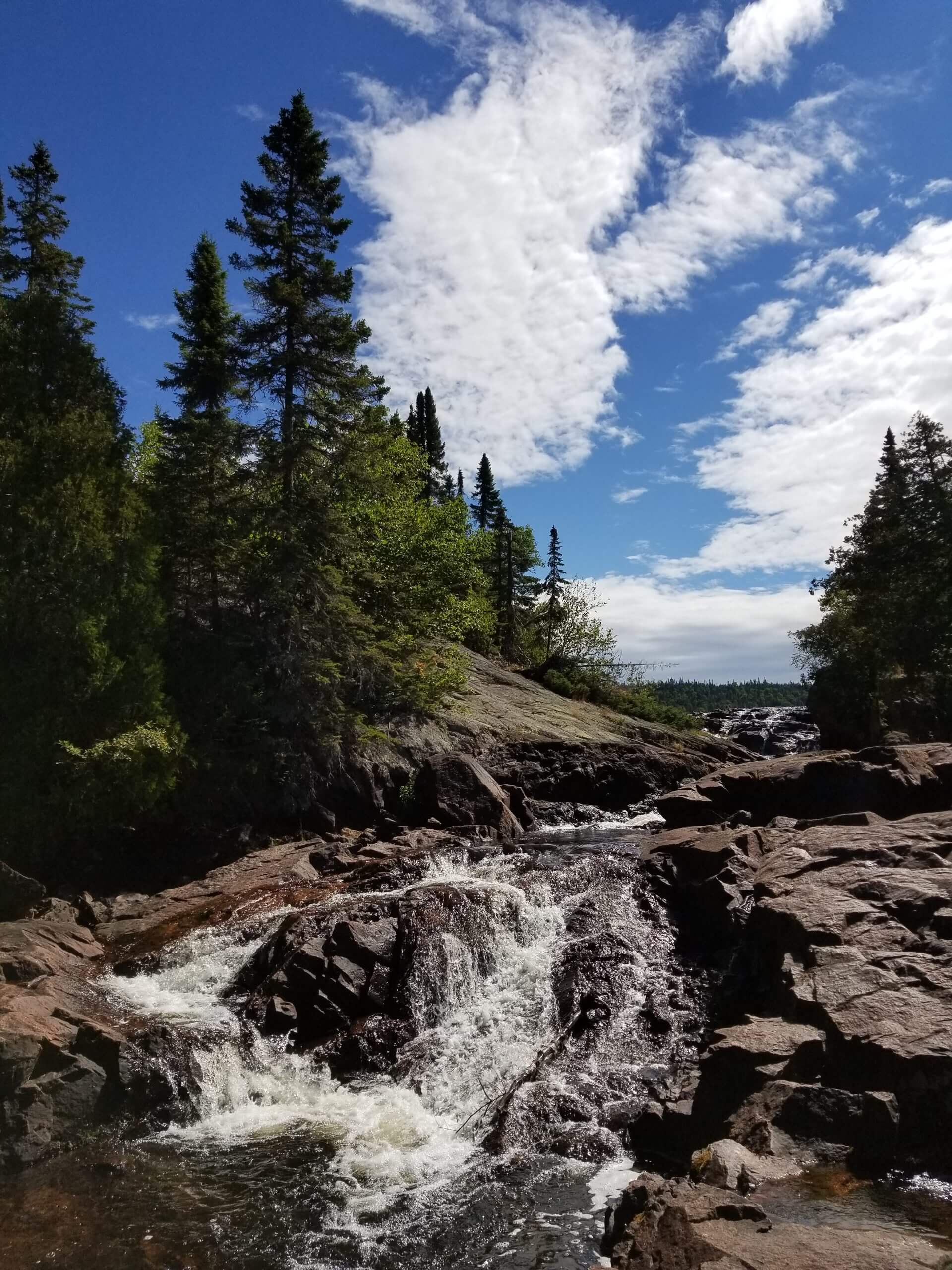
Rainbow Falls
Difficulty: Moderate/Hard (due to stairs)
Rainbow Falls is located east of Rossport. These cascading falls flow through the Whitesand Lake location at Rainbow Falls Provincial Park. A series of stairs lead you along the falls and is just a small portion of the 32.3 mile (52 km) Casque Isle Trail though you can access the falls directly from the park also. There are platforms and ledges along the way where you can get a closer look as well as benches to have a rest and enjoy the view. At the bottom, there is a bridge that goes over the cascades.

Casque Isles Hiking Trail
Difficulty: Hard
The Casque Isles Hiking Trail is located between Rossport and Terrace Bay in Ontario’s Superior Country. This is a 33 mile (53 km) point to point trail along the north shore of Lake Superior. The entire hike would take approximately 3-5 days though there are options to complete five different shorter segments and 11 access points.
Mclean’s Segment is 8.6 miles (14 km) between Rossport and Rainbow Falls Provincial Park. The Schreiber Channel is 8 miles (13 km) and is between Rainbow Falls Provincial Park and Schreiber Beach. The Mt. Gwynne Segment is 4.3 miles (7 km) between Schreiber Beach and Worthington Bay Road. The Death Valley segment is 6.2 miles (10 km) between Worthington Bay Road and Cottage Road. The Hydro Bay segment is 1.8 miles (3 km) between Cottage Road and Hydro Bay Road. The Lyda Bay segment is (6 km) and is between Hydro Bay Road and Terrace Bay’s Aguasabon Falls. There is so much to experience and incredible vistas along this trail. You will see old gold mines, fossil deposits, Indigenous pictographs, beaches, lookouts, waterfalls, creeks and of course, Lake Superior!

Kwewiskaning Coastal Trail
Difficulty: Hard
Kwewiskaning Coastal Trail connects Biigtigong Nishnaabeg (Pic River First Nations) to Neys Provincial Park. This is a 6.4 mile (10.4 km) point to point rugged trail on the coastline of Lake Superior. Kwewiskaning is Ojibway for “where the fish spawn”. At the trail’s south end at Pic River, there is a 900 foot boardwalk with two observation platforms offering stunning views of the lake.

Pukaskwa Coastal Trail
Difficulty: Hard
The Pukaskwa Coastal Trail is a 37.2 mile(60 km) point to point trail within Pukaskwa National Park. The trail climbs steep Lake Superior coastlines, through sandy and cobble stone beaches, and rugged boreal forests. Well equipped hikers will enjoy this challenging terrain, the White River Suspension Bridge with Chigamiwinigum Falls rushing below, unwinding at campsites, picturesque beaches and breathtaking vistas. Leashed dogs allowed.

Southern Headland Trail
Difficulty: Moderate
Southern Headland Trail is a 37.2 mile (2.2 km) out and back trail within Pukaskwa National Park. This rugged trail juts into Lake Superior with views of Hattie Cove, Pulpwood Harbour and Horseshoe Bay. The terrain of this trail includes, natural surfaces with built stairs, and some obstacles such as loose rock and tree roots. Leashed dogs allowed.

Mdaabii Miikna Trail
Difficulty: Hard
Mdaabii Miikna Trail is a 15 mile (24 km) loop trail within Pukaskwa National Park. Mdaabii Miikna translates to “go to the shore trail” in Anishinaabemowin. The trail is accessible from the Coastal Hiking Trail and features serene boreal forest and the impressive Lake Superior coastline at Picture Rock Harbour. This is a backcountry trail meant for overnight hikers.
ONTARIO’S ALGOMA COUNTRY TRAILS

Michipicoten Trail
Difficulty: Hard
The Michipicoten Trail is located near Wawa in Ontario’s Algoma Country. This is a (30 km) point to point trail that is a section of the Voyageur Trail. The trail runs from Highway 17 north just past the Wawa Tourist Information Centre and follows the Magpie River valley, passing High Falls, Silver Falls and Mission Falls, south along the Lake Superior coast to Bridget Lake.
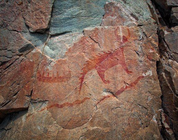
Agawa Rock Pictographs Trail
Difficulty: Moderate
Agawa Rock Pictographs Trail is located within Lake Superior Provincial Park. This is a 0.5 mile (0.8 km) loop trail that leads to the Agawa Rock Pictographs, one of the largest collection of Aboriginal pictographs in Ontario. The trail itself is remarkable for it’s unique geological features. A steep staircase carved from rock, steep cliff faces, and boulder-rocky pathways make the trek an experience all it’s own. Once you arrive at the pictograph it can be viewed from a rock ledge below the cliff along Lake Superior. A metal chain is bolted in to aid visitors on the ledge.

Orphan Lake Trail
Difficulty: Moderate
Orphan Lake Trail is also located within Lake Superior Provincial Park. This is a 5 mile (8 km) loop trail that follows past Orphan Lake, along Baldhead River and falls to the pebbly Lake Superior shore and back along the other side of Orphan Lake. This is a challenging and diverse rugged trail with plenty of rocks, roots, climbs and lookout views of Lake Superior. Leashed dogs allowed.

Nokomis Trail
Difficulty: Moderate
Nokomis Trail is also located within Lake Superior Provincial Park. This is a 3 mile (5 km) loop trail that follows Old Woman River and climbing through boreal forest. The trail offers multiple scenic lookout points that give an ideal vantage points of Old Women Bay. You may even be able to see the face of an old women immortalized in the cliff that rises 650 feet (200 m) above Lake Superior. The trailhead is located at the Old Woman Bay day use area. Leashed dogs allowed.

Sand River Trail
Difficulty: Easy
Sand River Trail is also located within Lake Superior Provincial Park. This is a (3.5 km) out and back trail that follows along the banks Sand River. The Sand River has multiple cascades and waterfalls that you will pass by on this trail with several drops of 10-15 feet . The trail leads to a back country camp site that is popular among canoeists. Leashed dogs allowed.

Awausee Trail
Difficulty: Difficult
Awausee Trail is located within Lake Superior Provincial Park. This is a 6.2 mile (10 km) loop trail that climbs uphill to a series of lookouts offering awe inspiring views of Agawa River Valley, Agawa Mountain, and Lake Superior. The highest point along this trail is at 650 feet (200 m) above the Agawa Valley. Leashed dogs allowed.

Towab Trail
Difficulty: Demanding
Towab Trail is located within Lake Superior Provincial Park. This is a 15 mile (24 km) point to point trail that mainly travels along the Agawa River, with beautiful canyon views, and to the 82 foot (25 m) high Agawa Falls. Due to the distance and effort of this trail it is recommended that hikers plan this as an overnight trip and stay at one of the several campsites along the way. Leashed dogs allowed.

Peat Mountain Trail
Difficulty: Hard
Peat Mountain Trail is located within Lake Superior Provincial Park. This is a 6.8 mile (11 km) loop trail that climbs to the summit of Peat Mountain. The mountain is a 500 foot (150 m) climb through diverse forest and overlooks ridges and valleys that have been formed by glacial activity, Lake Superior, and on a clear day you can even see all the way out to Michipicoten Island. The trailhead is accessed at Rabbit Blanket Campground near site #30. Leashed dogs allowed.

Pancake Bay Nature Trail
Difficulty: Easy
The Pancake Bay Nature Trail is located 47.6 miles (76.7 km) north of Sault Ste. Marie in Ontario’s Algoma Country. This is a 2.1 mile (3.5 km) point to point trail located next to the Pancake Bay Provincial Park campground. The trail begins along the shores of Lake Superior, over wooded beach ridges, through a wetland, then along a creek. There is a boardwalk that crosses over the wetland and interpretive signs are posted along the way that describe the unique and ancient features of the nature.

Harmony Beach/Haviland Bay Trail
Difficulty: Moderate
The Harmony Beach/Haviland Bay Trail is located near Goulais River, approximately 27 miles (43 km) north of Sault Ste MarieOntario. This is a 5 mile (8.2 km) point to point trail that runs parallel to the Trans Canada Highway 17 beginning near Old Mill Bay. The trail heads south through Harmony Beach to Tier Lake, then Havilland. Eagle’s Ridge Lookout above Harmony Beach offers incredible views over Harmony River and Lake Superior.

Stokely Creek Trail
Difficulty: Hard
Stokely Creek Trail is located in Goulais River in Ontario’s Algoma Country. This is a (13.1 km) point to point trail that is a section of the Voyageur Trail between Tier Lake and Robertson Lake Road. Along the way you will climb King Mountain and walk along the top of Robertson Cliffs both offering stunning views of the encompassing country and Lake Superior. This trail has different access points where you can decide to just hike sections of it. For maps visit the Voyageur Trail Associations website.

Goulais River Trail
Difficulty: Moderate
The Goulais River Trail is also located in Goulais River. This is a 10.4 mile (16.8 km) point to point trail that is a section of the Voyageur Trail. The trail runs mainly on old roads from Highway 552 East then southwest to cross Highway 17 and ends on Old Goulais Bay Road. For maps visit the Voyageur Trail Associations website.

John Rowswell Hub Trail
Difficulty: Easy
John Rowswell Hub Trail is located in Sault Ste. Marie Ontario. This is a 15.5 mile (25 km) multi use, non-motorized trail system that connects considerable points of interest. Cycle, walk or jog along this paved pathway that runs through and around the city. Some of this trails significant points are the waterfront walkway, Bellevue Park, Algoma University, Sault College, the hospital and Fort Creek Conservation Area.

Attikamek Trail
Difficulty: Easy
The Attikamek Trail is located in Sault Ste. Marie Ontario. This is a 1.6 mile (2.5 km) loop trail that begins at the Sault Ste. Marie Canal National Historic Site across the Lock gates on South St. Mary’s Island. This Island can be explored by foot or bike and visitors will experience incredible wildlife viewing in the wooded areas and wetlands. Look out for herons, ducks, frogs, racoons, squirrels and much more wildlife that inhabit the island. You will also walk under the International Bridge along this scenic trail.

Rains Point Trail
Difficulty: Easy
Rains Point Trail is located at Fort St. Joseph National Historic Site, 46 miles (74 km) south on Sault Ste Marie in Ontario’s Algoma Country. Rains Point Trail is a 0.3 mile (0.5 km) trail that is wheel chair accessible and winds through a wooded area until reaching the 1837 settlement that was founded by Major Rains on the shore of Lake Huron.
To plan your very own trip around Lake Superior use our Online Lake Superior Circle Tour Map and Trip Planner!